As Erin Pounds the Coast, Another Dangerous Storm Is Brewing
Hurricane Erin drives powerful waves toward the U.S. East Coast while a new tropical system forms behind it, raising fresh concerns

A Double Threat in the Atlantic
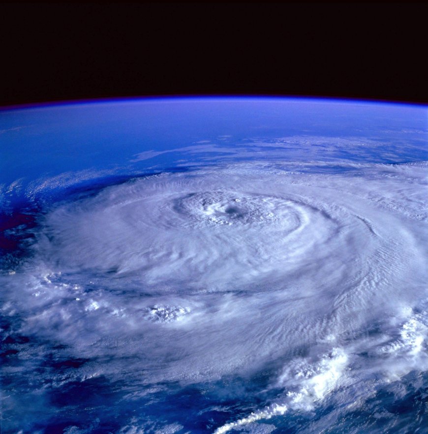
The Atlantic hurricane season has delivered a dramatic one-two punch this week. Hurricane Erin, churning offshore, is already sending towering waves and hazardous rip currents toward the U.S. East Coast. And as if that weren’t enough, forecasters are tracking a new tropical system forming in Erin’s wake—a potential storm that could complicate an already volatile season.
For coastal residents, the warnings are clear: beaches may look inviting under sunny skies, but the ocean tells a more dangerous story.

Erin’s Offshore Path, Coastal Impacts on Shore
Though Erin is not forecast to make landfall along the U.S. mainland, its sheer size and intensity are generating a powerful swell. Meteorologists say waves of 8 to 12 feet are likely to pound parts of the East Coast this week, with rip currents posing the greatest risk to swimmers.
From the Carolinas up to New England, lifeguards are bracing for busy days. Even experienced swimmers can be caught off guard, dragged offshore in seconds by invisible currents. Authorities are urging beachgoers to heed warnings, swim near staffed lifeguard stations, and resist the temptation of rough surf.
“Storms don’t have to come ashore to be dangerous,” one coastal safety official explained. “This is one of those times when the ocean’s power reaches far beyond the storm’s core.”
A New System Takes Shape in the Tropics
Behind Erin, in the warm waters of the central Atlantic, satellite imagery reveals another swirling mass of thunderstorms beginning to organize. The system, still unnamed, has already drawn the attention of the National Hurricane Center.
Forecasters estimate a growing likelihood that it will strengthen into a tropical depression—or even a named storm—over the next several days. Warm sea-surface temperatures, combined with favorable wind patterns, make conditions ripe for development.
At this stage, it’s too soon to predict whether the system will track toward the Caribbean, the U.S., or remain at sea. But its very presence underscores how quickly the Atlantic can reset after a hurricane, feeding one storm after another.
The Ripple Effect for Travel and Shipping
It isn’t only beachgoers who need to take note. Shipping companies are adjusting routes to avoid Erin’s expanding wave field, while some cruise itineraries are being modified to keep passengers out of turbulent waters.
Airlines, too, are keeping a close eye on conditions, as strong winds aloft from hurricanes can disrupt flight paths and schedules. While no widespread cancellations are expected yet, delays could ripple outward if storms intensify.
For East Coast communities, even the indirect impacts—eroded beaches, flooded coastal roads, disrupted ports—can carry heavy economic costs.
Storytelling Section: A Family’s Close Call
On a sunny afternoon in Virginia Beach, the Johnson family thought the ocean looked inviting. The storm was far offshore, the skies were blue, and dozens of people dotted the shoreline. Their 14-year-old son waded in, only to be swept sideways by a sudden rip current.
Within seconds, he was pulled out past the breaking waves. A lifeguard spotted the distress and dove in, rescuing him just as panic set in. The boy was safe, but the lesson hit hard.
“We didn’t realize how dangerous it was, because the storm wasn’t anywhere near us,” his mother admitted later. “Now we know the warnings aren’t just talk.”
Their experience reflects what officials fear most: that calm weather on land can lull families into underestimating storm-driven seas.
Why the Atlantic Is So Active Now
Meteorologists point to a combination of seasonal and environmental factors fueling back-to-back storms. Peak hurricane season—late August through September—is when the Atlantic is historically most active. This year, record-warm ocean temperatures are adding extra fuel to developing systems.
Key drivers include:
-
Warm Sea-Surface Temperatures: Providing more energy for storm intensification.
-
Low Wind Shear: Allowing storms to grow vertically without being torn apart.
-
Moist Atmosphere: Enhancing thunderstorm development.
Together, these conditions set the stage for rapid-fire storm formation.
What Coastal Residents Should Do Now
Even without a direct landfall, East Coast residents are advised to remain vigilant. Safety officials recommend:
-
Avoiding the surf during periods of strong rip current advisories.
-
Checking local forecasts daily, especially if planning beach trips.
-
Preparing for indirect flooding in low-lying coastal areas.
-
Reviewing emergency plans in case the new system strengthens and shifts toward land.
Preparedness now can save lives and reduce panic later.
Looking Ahead: Will the New Storm Threaten Land?
Forecast models remain divided on the trajectory of the emerging system behind Erin. Some project it curving harmlessly into the open Atlantic, while others suggest a path closer to the Caribbean or U.S. coastline.
Experts stress that it’s too early to tell—but also that conditions are favorable for rapid development. The next 48 to 72 hours will be crucial in determining its path.
For now, the message is simple: stay alert, stay informed, and don’t underestimate the ocean’s reach.
Conclusion: A Season Demanding Vigilance
Hurricane Erin may remain offshore, but its effects are already being felt on East Coast beaches. With another tropical system brewing in its wake, the Atlantic is reminding residents that hurricane season is far from over.
As waves crash, forecasts update, and a new storm takes shape, one lesson stands out: preparation and respect for nature’s power are the best defenses.
For families heading to the beach, for sailors navigating shifting seas, and for coastal communities keeping watch—the message is the same. This is a season to stay vigilant.
FAQs
1. Is Hurricane Erin expected to make landfall in the U.S.?
No, Erin is forecast to remain offshore, but it will still send dangerous waves and rip currents to the East Coast.
2. Why are rip currents so dangerous during hurricanes offshore?
Storms generate strong, hidden currents that can pull swimmers away from shore quickly, even under sunny skies.
3. What is the new tropical system forming behind Erin?
It’s an area of thunderstorms in the central Atlantic that could develop into a tropical depression or named storm in the coming days.
4. How long will East Coast beaches face dangerous waves from Erin?
Hazardous surf and rip currents may persist for several days, depending on Erin’s size and track.
5. When is the peak of Atlantic hurricane season?
The peak typically occurs from late August through September, when conditions for storm formation are most favorable.
What's Your Reaction?
 Like
0
 Dislike
0
 Love
0
 Funny
0
 Angry
0
 Sad
0
Sad
0
 Wow
0
Wow
0


