


Hurricane Erin Threatens East Coast with Deadly Surf
Hurricane Erin churns toward the East Coast, bringing life-threatening surf, rip currents, and coastal dangers, maps show its forecasted path.

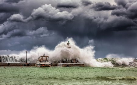
Hurricane Erin, the latest storm in the Atlantic hurricane season, is gathering strength and heading toward the East Coast. Forecasts warn of life-threatening surf and dangerous rip currents, prompting coastal residents and tourists to brace for impact.
Meteorologists caution that while Erin’s exact landfall is still uncertain, its powerful waves and high-speed winds are expected to challenge even experienced swimmers and boaters. Emergency officials are urging the public to stay vigilant and monitor real-time updates.

Erin’s Current Status and Path
Hurricane Erin formed over the warm Atlantic waters and has rapidly intensified in recent days. According to weather tracking data:
- Category: Currently a Category 2 hurricane, with winds exceeding 100 mph.
- Projected path: Moving northwest toward the Mid-Atlantic and Northeastern U.S.
- Speed: The storm is advancing at roughly 15 mph, with potential acceleration depending on atmospheric conditions.
- Uncertainty: Minor deviations could significantly alter which coastal regions will experience the heaviest surf and flooding.
Experts emphasize that even areas not directly in the projected path may experience hazardous conditions, including rough seas and strong rip currents.
Forecasted Coastal Impacts
The East Coast faces a variety of potential hazards as Hurricane Erin approaches:
- Life-threatening surf: Waves could reach heights of 10–15 feet in some regions.
- Rip currents: Strong, unpredictable currents could sweep swimmers far from shore.
- Beach erosion: Persistent wave action threatens dunes and coastal structures.
- Flooding in low-lying areas: Storm surge combined with high tides may inundate streets and homes.
Authorities advise residents and tourists to avoid beaches and waterfront areas, secure boats, and follow evacuation orders if issued.

Maps Show Erin’s Predicted Path
Satellite imagery and forecast models provide critical insight into Erin’s likely trajectory:
- Initial trajectory: Offshore, moving parallel to the Carolinas.
- Mid-Atlantic threat: Potential impact on Virginia, Maryland, and Delaware coastlines.
- Northeast projection: Uncertainty remains for New Jersey, New York, and southern New England.
Meteorologists remind the public that forecast maps are not exact predictions, and even small changes in direction could dramatically affect which areas experience severe conditions.
Safety Precautions for Residents and Tourists
Local authorities and emergency services are emphasizing proactive measures:
- Avoid the water: Strong surf and rip currents pose lethal risks.
- Secure property: Board windows, tie down outdoor objects, and reinforce structures.
- Follow official guidance: Stay tuned to local advisories and evacuation orders.
- Emergency kit: Stock up on food, water, medications, and essential supplies.
These steps are crucial, as Hurricane Erin’s surge and waves could create hazards even for those not in the immediate path of the storm.
Emotional Impact: Coastal Communities Brace
For many residents along the East Coast, Hurricane Erin is a source of anxiety and uncertainty.
Mary Jenkins, a small business owner in Virginia Beach, recalls past storms vividly. “Every hurricane season feels like a gamble,” she says. “You never know if you’ll just weather it or if it will cause real damage. Erin has everyone on edge.”
Families are evacuating beachside homes, and tourists are canceling vacations as emergency alerts circulate. The emotional toll of storm preparation—combined with the disruption of daily life—underscores the human dimension of natural disasters.
Historical Context and Comparisons
Hurricane Erin comes amid a season already marked by intense storms. Historical patterns reveal:
- Increasing intensity: Climate change has contributed to warmer ocean waters, fueling stronger hurricanes.
- Previous similar storms: Hurricanes along the East Coast have caused devastating rip currents, flooding, and property damage.
- Preparedness lessons: Communities that take early warnings seriously typically fare better during and after storms.
Understanding Erin in the context of past hurricanes helps officials and residents plan more effectively and mitigate potential damage.
Long-Term Implications for the East Coast
Beyond immediate threats, Hurricane Erin could have lasting effects:
- Economic disruption: Local businesses, particularly tourism and fishing industries, may face temporary closures.
- Infrastructure challenges: Roads, bridges, and coastal utilities may sustain damage.
- Environmental impact: Beaches and dunes could erode, affecting habitats and long-term coastal resilience.
Investments in storm preparedness and resilient infrastructure are increasingly critical as climate-related hurricanes grow more frequent.
Conclusion: Vigilance Remains Essential
Hurricane Erin is a stark reminder of the power and unpredictability of natural disasters. While forecasting technology has improved, the storm’s exact impact will only become clear as it approaches the East Coast.
Residents and visitors must prioritize safety over curiosity, heed warnings, and prepare for life-threatening surf and dangerous rip currents. The storm underscores the ongoing need for awareness, preparedness, and resilience in coastal communities.
By staying informed and cautious, individuals can reduce risk and navigate the dangers of Hurricane Erin with greater security.
FAQs
1. Which areas are most at risk from Hurricane Erin?
Coastal regions along the Mid-Atlantic and Northeastern U.S., including Virginia, Maryland, Delaware, New Jersey, and southern New England, are likely to face the strongest surf and rip currents.
2. What makes Hurricane Erin particularly dangerous?
Life-threatening surf, strong rip currents, and potential flooding are major hazards, even in areas not directly hit by the storm.
3. How can residents prepare for the storm?
Evacuate if instructed, secure property, avoid water, and keep an emergency kit with essential supplies.
4. Are rip currents really life-threatening?
Yes. Rip currents can pull even strong swimmers far from shore, leading to drowning if precautions are not taken.
5. Will Hurricane Erin affect tourism and local economies?
Yes, businesses may close temporarily, beaches will be unsafe, and coastal tourism and fisheries may experience disruptions.
What's Your Reaction?
 Like
0
Like
0
 Dislike
0
Dislike
0
 Love
0
Love
0
 Funny
0
Funny
0
 Angry
0
Angry
0
 Sad
0
Sad
0
 Wow
0
Wow
0